
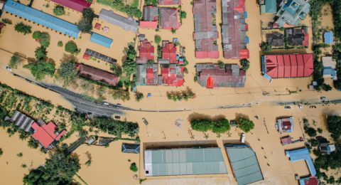
Mapping of Flooded Areas using Geospatial Technology: A Case Study
Flooding, one of the most common and destructive natural disasters, has …
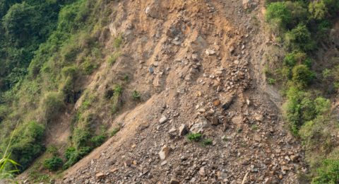
Landslide Vulnerability Mapping Using Geospatial Technology
Landslides are one of the most common natural disasters that affect …
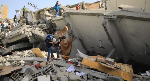
Application of Remote Sensing and GIS for Earthquake
Mapping of earthquakes using remote sensing and GIS (Geographic Information Systems) …