The power of maps
July 22, 2021 2022-09-15 0:20The power of maps
The stages of the evolution of maps throughout history
- The maps facilitated the ways of trade in the Sumerian civilization to describe the place by mapping the boundaries of agricultural lands, determining their ownership, and drawing on clay. They were interested in mapping the cities, so Iraq is considered one of the oldest areas that interested in maps.
- It was used to collect taxes at the Pharaohs and is considered the oldest map of Egypt during the reign of Ramses II of the provincial borders
- The Chinese maps were designed on the sand for military purposes before 500 BC
- Roman Maps The Romans cared for maps for military purposes
- European maps were intended to distribute the holy places
- Arabs used it on trade paths
- The Renaissance in Europe witnessed major development in cartography
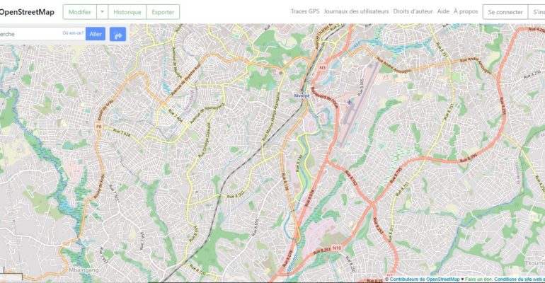
The map:
It is a tool to read reality to change or maintain it and evaluate it as it is used by many users in different fields such as geology, hydrology, urbanism, population, and health, so there is no study of the place without a map.
The map contributed to the development of many sciences such as geography and planning, and other sciences such as geographic information systems and geomatics were established, which supported the role of the map.
Maps use:
The role of the map in studying the population:
Its importance is highlighted in the study of the geographical distribution of the population, the areas of concentration, the centers of dispersion and emptiness, the quality of the population, the interpretation of the causes and work on them.
The role of the map in urban
Its importance is highlighted in the study of urban areas, urban patterns, the potential for future expansion, urban encroachments, and the burden on services.
The role of the map in agriculture and water
The role of the map is highlighted in the study of cultivated areas, types of crops, distribution of water requirements for crop irrigation, the study of soil, its quality, and its suitability for cultivation.
Uses of maps in the industrial and geological fields
Its role is highlighted in theories of endemicism, limestone extraction alongside cement and gypsum factories, gold extraction alongside gold factories, petroleum extraction, alongside petroleum refineries and pharmaceutical factories, alongside more low-health areas and pharmacies.
Uses of maps in environmental management:
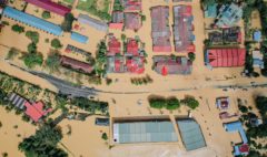
The role of the map in the management of the environment in the forest areas and its removal and the distribution of greenhouse gases and their geographical distribution are studied, and a study of their impact on sea-level rise, coastal flooding, disease spread among animals, fish and birds and their relationship with humans.