About This Course
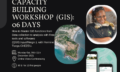
Olbgis Conference 2020 is the leading conference for GIS specialists that unites immersive learning,
hands-on training, collaboration, networking, and fun.
We also encourage immersive and outcomes-focused peer-to-peer exchanges. Over three intensive days, our attendees will get deep insights into the GIS industry that will enable them to take their GIS career and GIS activities to the next level.
This event was held online on November 2020
Learning Objectives
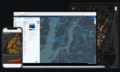
You will understand how GIS (Geographical Information System) is changing the world through its usage and applications.
During the conference, we will present you with 02 GIS applications to help you open your mind to how GIS is affecting your daily life.
The first topic will be GIS in Utilities: Upstream & Downstream Network; Operations Management in GIS. Incident Management. Reporting & Business Intelligence.
The second topic will be: Application of GIS and remote sensing in agriculture (case of Egypt), you will better understand crop productivity and monitoring using the Crop Assimilation Model tool in GRASS GIS.
Material Includes
- Video
Requirements
- This course is designed to be an introduction to the topic and no prior knowledge nor experience is required.
Target Audience
- Gis specialists or beginners who are passionate about Geographical Information systems or you want to learn more about GIS Applications & Uses.
Curriculum
3 Lessons
GIS For Utilities : Day 1
GIS For Utilities: Upstream and downstream Network, the link between entity and others. Way to improve Operations management in GIS. Incident management
GIS For Utilities : Olbgis Conference 2020 (Day 1)37:08
Application of GIS and remote sensing in agriculture (case of egypt)
Application of GIS and remote sensing in agriculture (case of Egypt):
- Agriculture
-Crop forecasting
-Crop irrigation
-Irrigation
GIS For Utilities : Reporting and Business Intelligence (Day 2)
GIS For Utilities : Reporting and Business Intelligence
Your Instructors
Olbgis Consulting firm specializes in GIS services.
GIS Consulting Services
Olbgis is a consulting firm specializing in Geographic Information System services. Our goal is to challenge how companies benefit from the top 10% expert. By relying on a large network of consultants, we have built an organization to offer tailor-made expertise solutions that integrate the specificities of customers.
See more

Mohamed Arafa Arafa Ali Salam
I have a master's degree in geography, geography Ph.D. researcher, GIS, and Remote Sensing expert, I'm working at the ministry of agriculture in Egypt, I'm teaching gis and remote sensing using a lot of central research, universities in Egypt, and freelancer on Upwork platform.
See more

Marcel Cedric Ebelle
- Head of Digital Applications chez Eneo Cameroon S.A.
- Data Management
- IT Value Enhance Enterprise
- Analytics- Business Intelligence
Université de Picardie Jules (Verne Amiens)
See more
Write a review
Free
Material Includes
- Video